Further, the GEFS does no interpolation and assigns the nearest grid value to TUS. The map below was provided by Mike Crimmins back when we were first hashing around this issue.
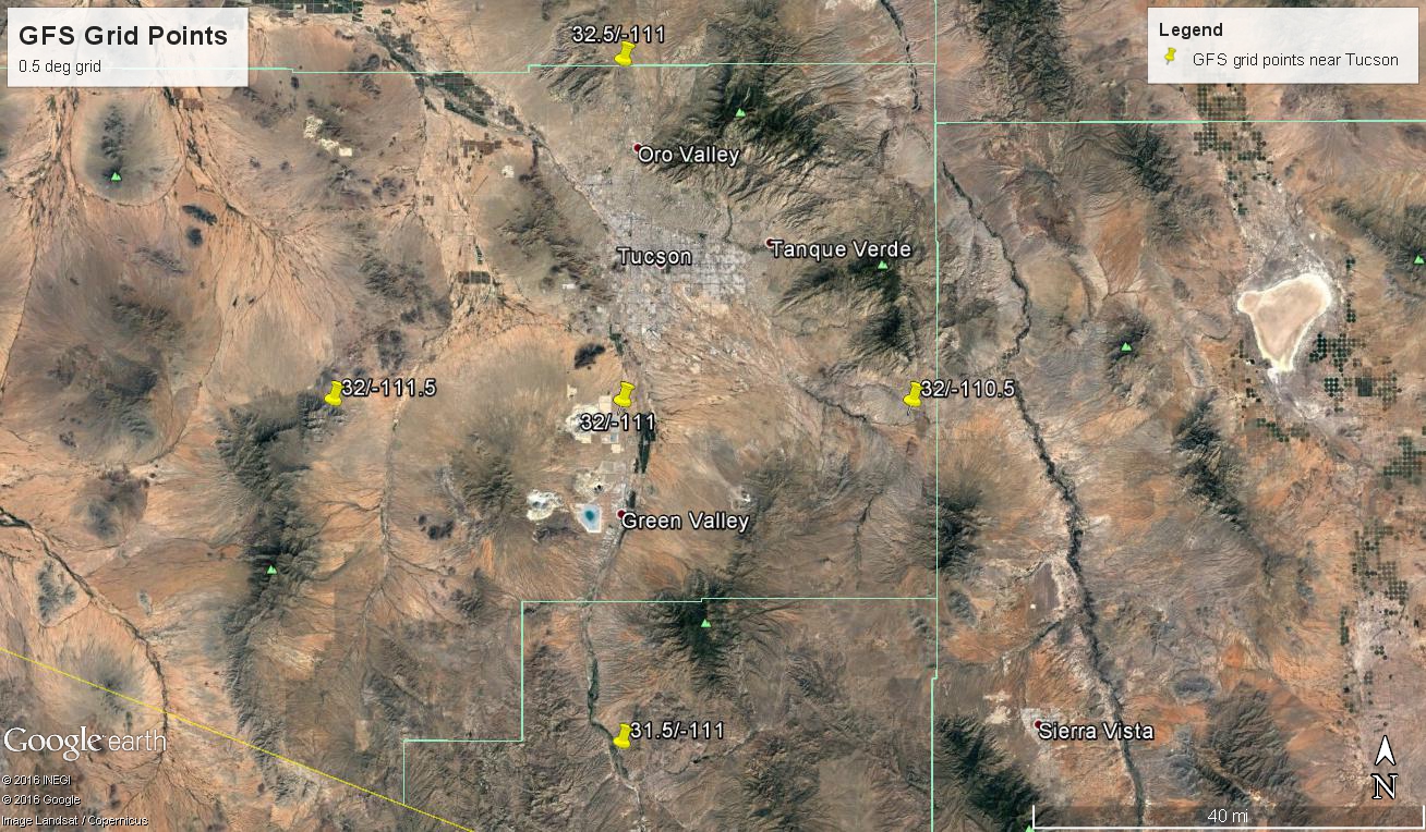
The grid map for the GEFS ensemble members for Arizona (below - provided by Tracey Dorian of NWS EMC) shows the location of TUS as a red triangle. Map at bottom also shows this point. The grid point is exactly the same as the one south of airport as provided by Mike.
The distance between the closest grid point and the airport is about 15 km and the grid point surface elevation is about 136 ft higher than the ASOS site at airport. So there is only a small amount of upslope or downslope missing from the GEFS plumes for Tucson.


No comments:
Post a Comment